Roopkund Trek- The Most Popular Trek In India
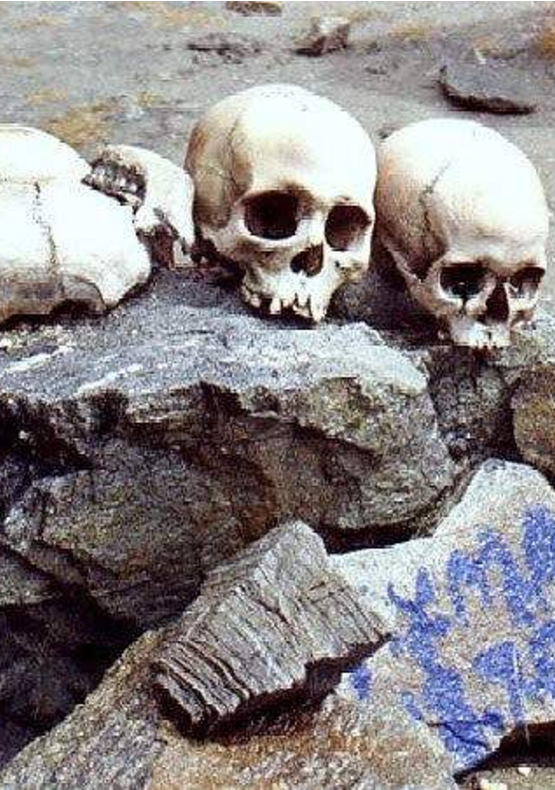
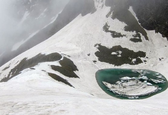
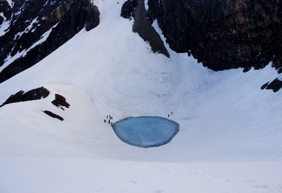
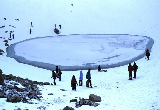
Roopkund (locally known as Mystery and Skeletons Lake) is a high altitude glacial lake in the Uttarakhand state of India. It lies in the lap of Trishul massif and is famous for the hundreds of human skeletons found at the edge of the lake. The area is uninhabited, in the Himalayas. Surrounded by rock-strewn glaciers and snow-clad mountains, the lake is a popular trekking destination. A shallow lake, having a depth of about two metres, Roopkund has attracted attention because of the human skeletal remains that are visible at its bottom when the snow melts. Many theories and opinions exist, from purely spiritual to scientific ones, attempting to explain the existence of these skeletons, which date back to 9th century CE. Because of the human remains, the lake has been called Skeleton Lake in recent times.
Short Itinerary
Day 1: Reach at Lohajung (7,600 ft.), 210 Km drive from Rishikesh
Day 2: Lohajung Base Camp to Didna Village via Kuling village - 9 km | 8145 Ft
Day 3: Didna Village to Abin Kharik via Ali Bugiyal & Tolpani - 12 km | 12200 Ft
Day 4: Abin Kharik to Bahkuwabasa via Bedani, Pater Nachoni & Kalu vinayak - 12 km | 14000 Ft
Day 5: Bhagwabasa to Roopkund (Junargali) and back to Bhagwabasa - 10 km | 16000 Ft
Day 6: Bhagwabasa to Ghairoli Patal via Bedni Bugyal- 15 km | 11,000 Ft
Day 7: Ghairoli Patal to Lohajung via Wan & Ranka Dhar. Drive from Wan to - 5 km | 7662 Ft
Day 8 : Drive from Lohajung to Rishikesh
Detail Itinerary
Day 1
Reach at Lohajung (7,600 ft.), 210 Km drive from Rishikesh
Drive to Lohajung which takes about 9-10 hours from Rishikesh with stunning views of high altitude peaks like Trishul, Maiktoli, Nanda Devi, Ghori Parvat, Nanda Khat, Hathi Parvat, and Ghori Parvat. Take a small halt at “Teen Dhara” for refreshments and make some memories with your camera as the views here are seriously unforgettable. Lohajung serves as the beginning point and the base camp for the Brahmatal trek. After reaching Lohajung, the stay will be in Guest House/Camp/Homestay on sharing basis. There are many local shops where you can buy jackets, hand gloves, caps, shoes, etc. if need be. However, it is advised that you carry all the required things for trek beforehand and not rely on any shop.
Day 2
Lohajung Base Camp to Didna Village via Kuling village - 9 km | 8145 Ft
Just behind the bus stand in Lohajung take the trail that takes you to Raun Bagad. It is a fairly marked trail that descends through mixed forests. It is a moderate trek and you would take around 2-2½ hrs to reach the Ruan Bagad, which is an iron bridge across the famous Neel Ganga river. There is also an alternative route to reach here from Lohargunj which is through the road towards Wan. It is an easy 6km drive to Kulling Village where after there is a steep slope towards Ruan Bagad. You can opt for the latter, which is easy to travel but you would certainly miss the beautiful mixed forests. Hereafter the climb to Didina starts once you cross the iron bridge. It is a difficult climb and you may get tired pretty soon. With a relatively tough time in the beginning, you would reach Didina in about and an hour and a half time. You would have great mountaineering experience all this while. Overnight stay will be in Home stay or Camp.
Day 3
Didna Village to Abin Kharik via Ali Bugiyal & Tolpani - 12 km | 12200 Ft
TTo reach Bedni Bugyal from Didna, there are two alternative routes. If you look in the direction of the valley, you would look at Tolpani, which is a cluster of huts that belong to the shepherds. It is almost 3 kms away and 1000 feet high. From Tolpani, you take a trail that climbs to Tolkaan in the northern direction. The meadow trek goes through a series of switchbacks and grassy oak mountains. From Tolkaan, you take a sharp left towards the south and steer through the ridge to come out of the forest at Ali Bugyal. The alternative route is to climb directly towards Bedni Bugyal without going through Toplani. It takes nearly two and a half hours to reach Ali Bugyal on this route. To enjoy the seductive views from Ali Bugyal, you need to reach there before afternoon. It is a great post monsoon trek as well as a pre monsoon trek Incredible view of Valley. Click memories on your cameras, start trek to Bedeni bugyal slightly ascend but not tough, 1.5 -2 hours will take to reach Bedani Bugyal, Overnight stay in tents.
Day 4
Abin Kharik to Bahkuwabasa via Bedani, Pater Nachoni & Kalu vinayak - 12 km | 14000 Ft
The trek from Bedni Bugyal to Patar Nachauni is an easy trek. You would follow a straight line ahead. On your gradual increase to the slope, the trek brings you to the other side of the ridge. The view from this point is absolutely marvelous. Explore the morning view of Bedni Bugyal, around green grass, Bedeni kund, View of patti ka danda. According myth Lord Brahma created here Vedas. After breakfast depart to Patar Nachauni, 5 km distance takes 2-3 hours to reach. Today all around view is full of charm, Mountain (Nanda Ghughunti, Trishuli), Water falls, small-small watre lakes between meadows. Night halt in camp.
This is the day when you make a steep dash to gain altitude and finally trek in the snow line. It is an high altitude trekking and you would start feeling the effects of weather change and thin air and definitely the effects of high altitude. You would have to start your day early as you would like to reach Bhawabasa as early to acclimatize to the weather. Your route takes a climb to Kalu Vinayak, which is a steep and zigzag way to take you up the mountain. Go through this section carefully and slowly. It takes around one and a half hours to reach Kalu Vinayak. The route from Kalu Vinayak to Bhagwabasa is simple and gradually sloping downwards. Bhagwabasa is 2 kms away and you can have a view of the Bhagwabasa huts from here. The trail towards Bhagwabasa goes through snow patches and you would enjoy the journey.
Day 5
Bhagwabasa to Roopkund (Junargali) and back to Bhagwabasa - 10 km | 16000 Ft
You have to start the day as early at 4 am. The sooner you start, the better it is for you as the snow is still hard, while later in the day, it would get soft and your feet would start sinking in. Roopkund is a 3 km gradually up-hill climb from Bhagwabasa. You will have steep climb towards the end of the trail to reach Roopkund. It would take about 3 - 3½ hours to reach Roopkund. Once you climb to Roopkund, you must climb up to Junargali. Trekkers must visit unless the weather is very harsh and does not permit you. The climb to Junargali is not long. It is around 200 ft and doesn't take much time. It is hardly a climb of 25 - 30 min. You can start off early to return back to Bhagwabasa. You need to be careful in trekking back as the snowy slopes may trick you.
Day 6
Bhagwabasa to Ghairoli Patal via Bedni Bugyal- 15 km | 11,000 Ft
This is the day we will return back to Ghairoli Patal. We will start our trek in the early morning after spending some time at Bhagwabasa, we will descend without delay as the weather at these high altitudes changes suddenly. It can get windy up here and possibility of sudden rain cannot be ruled out. We also might rest at Pathar Nachauni if the weather permits, as it doesn’t take much time. Reach Bedni in around 5 hours. And from here a 2km descend from Bedani to Ghairoli Patal which you will cover in 1 hour. You can camp at Ghairoli Patal for the night.
Day 7
Ghairoli Patal to Lohajung via Wan & Ranka Dhar. Drive from Wan to - 5 km | 7662 Ft
From Ghairoli, it is a steep ridge descent to the Neel Ganga. Faster trekkers reach the river in one and a half hours. The slower ones take two. Take your time because you will rarely see a more wondrous stretch of forest cover. The bridge on the Neel Ganga is an idyllic location to wash the dirt and grime of the long trek. Trees overhang the river and the water trips and falls over boulders in the shade. The water is cool and refreshing. From the river it is a short half hour climb to the ridge above Wan village.
There are many routes to the bottom of the Wan village, and all roads eventually lead down to the road junction (Kasar Bagad) near the hydel project. It takes about an hour and half to get down to Kasar Bagad. It is a steep descent.
There is an alternative longer route to get down to Wan. From the ridge top of Wan, take the main trail that runs to the right. Follow the trail until it reaches the Cyprus trees at the lower Wan village. Spend time looking at the Cyprus trees because they are centuries old!
You’ll take a jeep from Wan to Lohajung. It’s a drive of about 45 mins.
Day 8
Drive from Lohajung to Rishikesh.
You’ll leave for Rishikesh early in the day. You will reach Rishikesh between 5 pm and 6 pm.
Check out the reaching the basecamp section for more details about getting back after your trek.
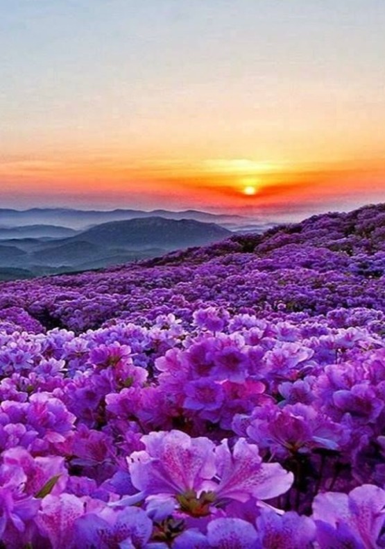
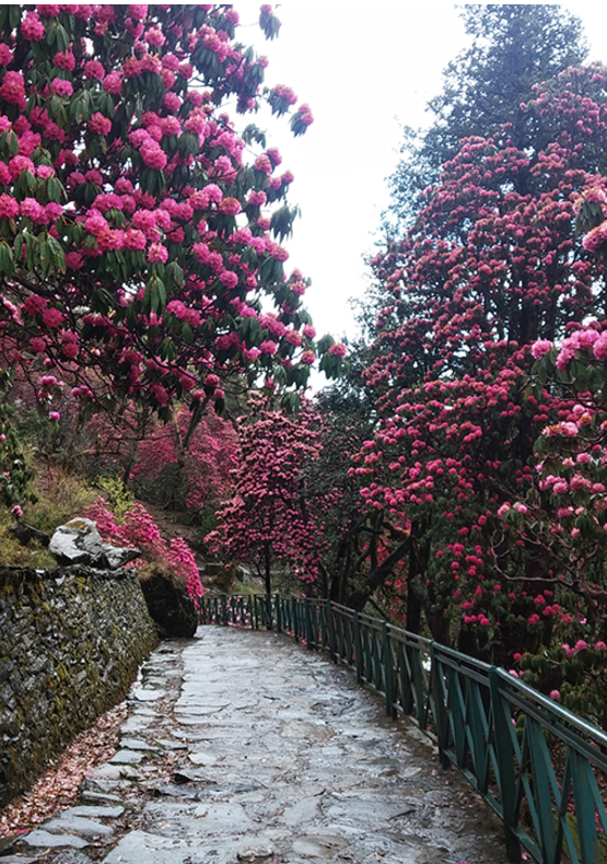
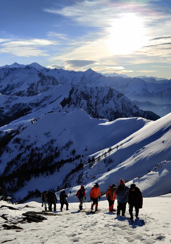
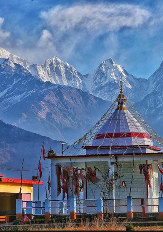
Photo Gallery
Other Information
Price Includes
- Accommodation. (Guest house, Home stay, Camping)
- Meals while on trek (Veg.+ Egg)
- Trek equipment: Sleeping bag, mattress, tent (twin sharing), kitchen & dining tent, toilet tent, utensils and crampon (if required).
- All necessary permits and entry fees
- First aid medical kits and oxygen cylinder
- Mountaineering qualified & professional trek Leader, guide, cook and Support staff
- Porters/mules to carry central equipment
- Transport Rishikesh to Rishikesh
Price Excludes
- Any kind of personal expenses
- Food during the transit (Day-1 breakfast at Rishikesh and lunch on the way)
- Insurance
- Any kind of emergency evacuation charges
- Mules or porter to carry personal backpack
- Anything not specifically mentioned under the head
- Accommodation in Dehradun
- Travel insurance and other emergencies.
This was my 2nd experience with them. It was educational, benefitial, reflective, fun, interesting, friendly, disciplined .. Considering the fact that it was in the remote hills, yet The Mountain Trekker provided such splendid facilities, I'll add luxurious.
Sumit was awesome, awesome being an understatement. He not only was informative regarding the trees, environment, birds, mountains, trails, Gaia, local language, rock climbing